Mission Briefing
For the Colorado resident, "water" is usually synonymous with "snowpack." We spend our winters eyeing SNOTEL maps, praying for the "white gold" that fuels our summer crops and rivers. But in October 2025, the Southern Rockies experienced a structural shift in how our mountains collect water—not through a slow winter freeze, but via a high-velocity, tropical-fueled "Beneficial Disaster."
As we move through February 2026, this event has become the only thing standing between the Rio Grande Basin and a catastrophic water shortage.
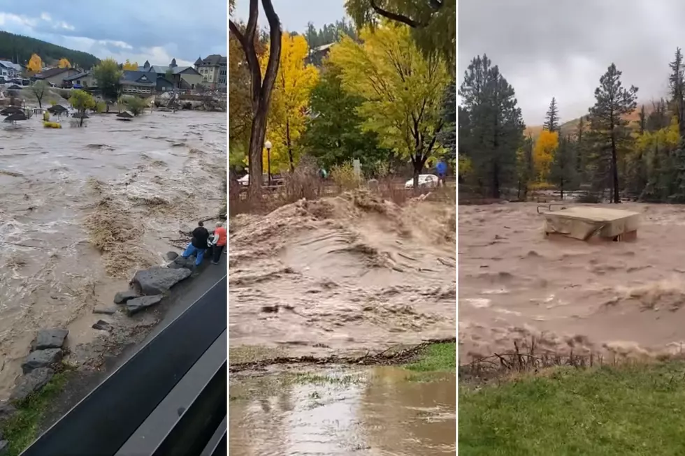
Watch the rivers take a "deep breath" as the precipitation passes over San Luis Valley

The Anatomy of the Event: An Atmospheric Coup
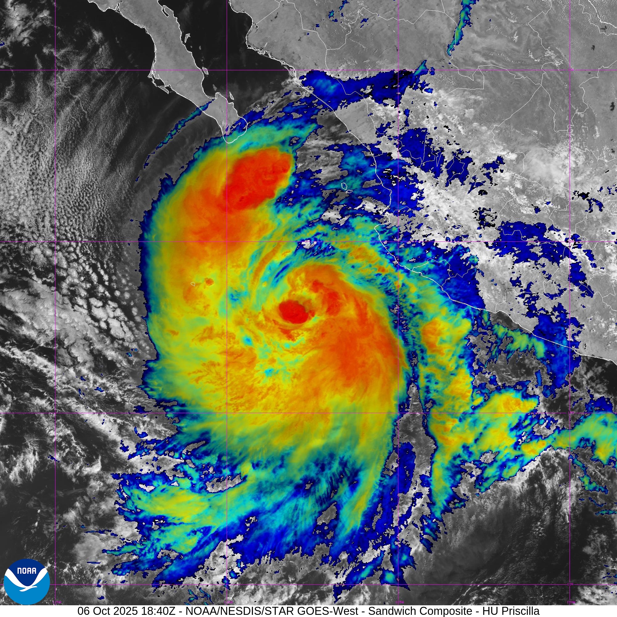
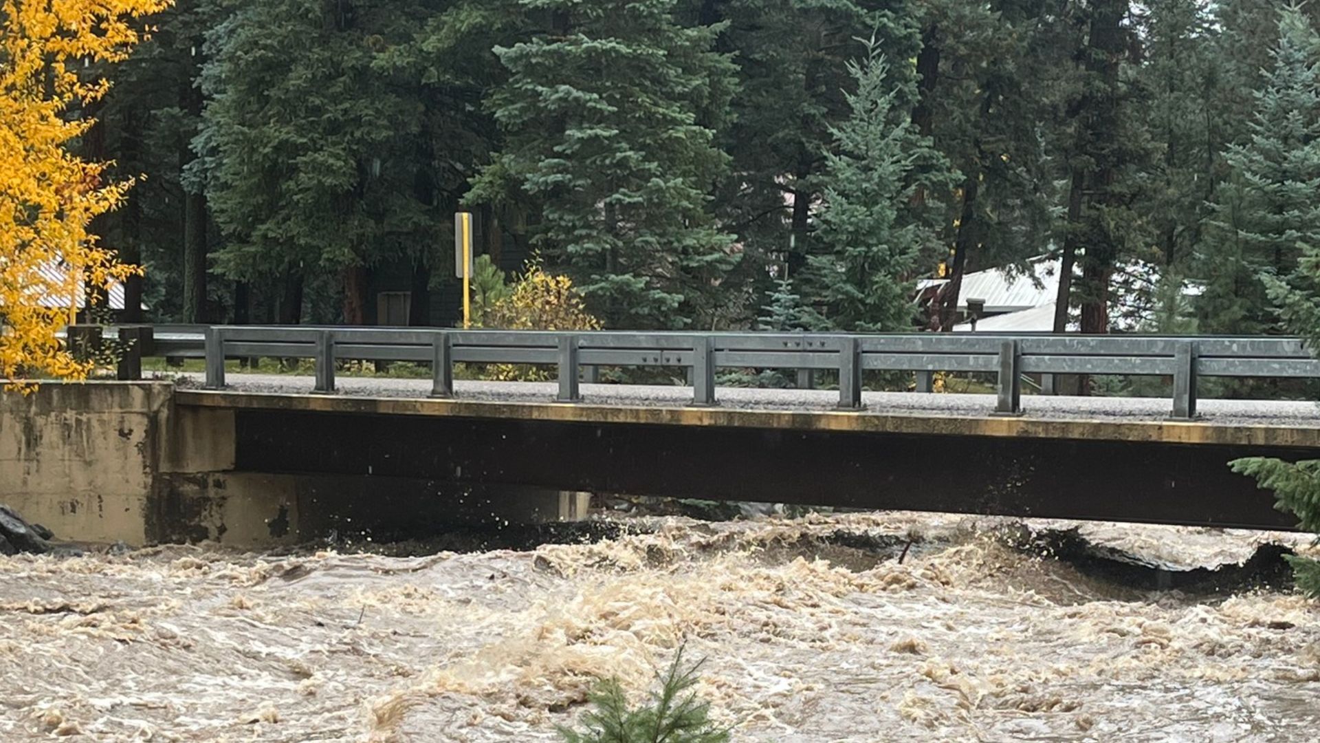
The event was triggered by a rare alignment of tropical energy and mountain geography. A meridional atmospheric river—a narrow, high-pressure corridor of moisture—collided with the remnants of Hurricane Priscilla.
As this moisture slammed into the San Juan Mountains, orographic lift (the process of air being forced upward by terrain) squeezed out 12.5 inches of liquid precipitation in just five days. To put that in perspective: the region received a full year's worth of water in less than a week.
The 2026 Context: The Snow Drought Paradox
Current telemetry presents a grim visual: statewide, Colorado's snowpack is hovering near the 5th percentile, a dry start seen in only about 5% of recorded years. In the southern basins, including the Upper Rio Grande, the Snow Water Equivalent (SWE) is stuck at approximately 50–60% of the early February median.
Typically, these numbers would signal an impending drought. However, the October Surge has "banked" water in a way the snowpack cannot.
The "Soil Bank" Bailout
Normally, dry mountain soils act as a "tax" on spring runoff, absorbing the first 20–30% of melting snow before a single drop reaches the river. Because the October floods saturated the deep soil column to nearly 100% capacity just before the winter freeze, that "tax" has been eliminated.
When the meager 2026 snowpack eventually melts, it will slide over an impenetrable, saturated surface, delivering water directly to our reservoirs with hyper-efficiency.